
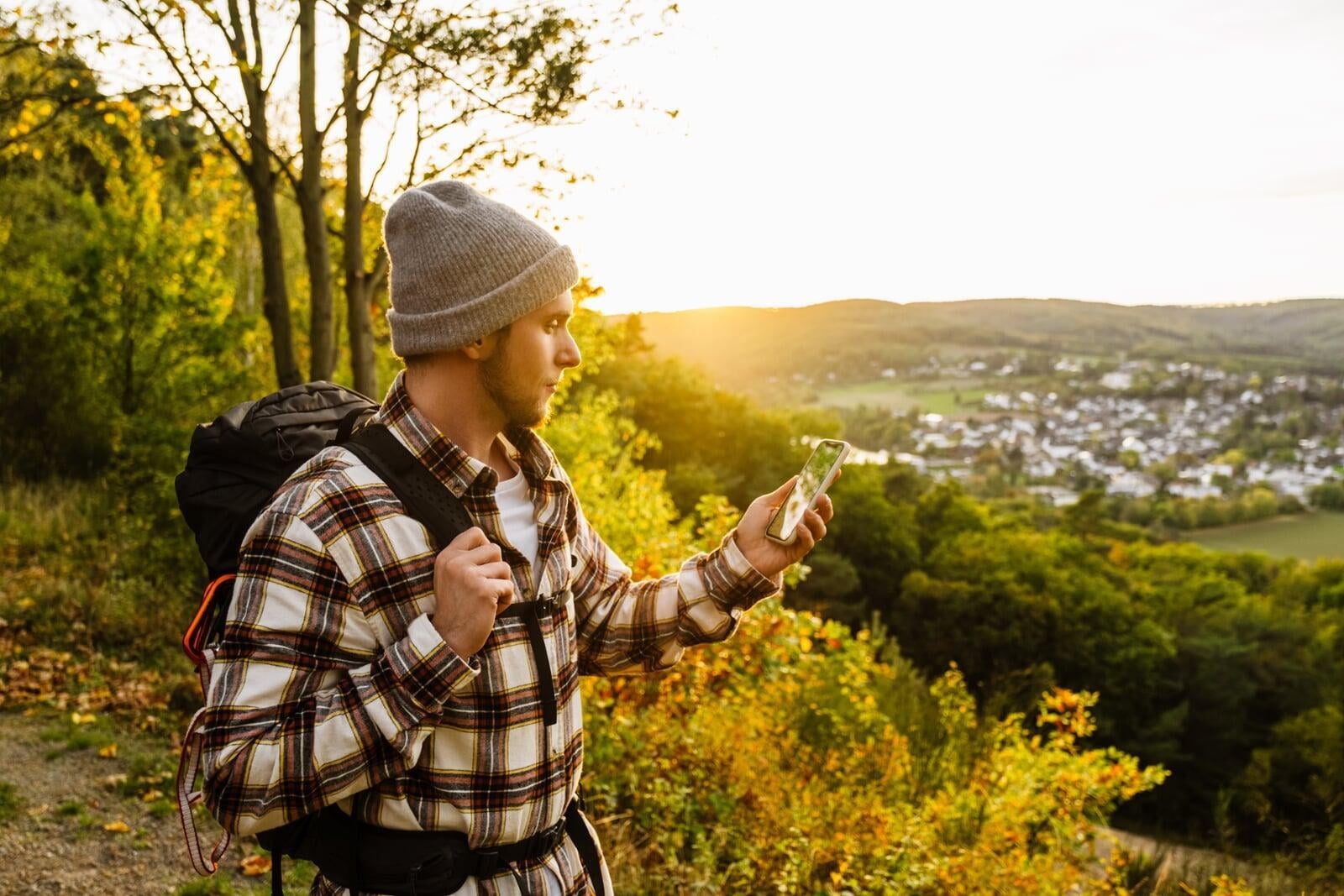
Be honest — nobody likes working their way through websites and extensive texts looking for information and in the case of everyday navigation, it is safe to say that we have all grown accustomed to the convenience and ease of using Google Maps and our car's satnav to get around.
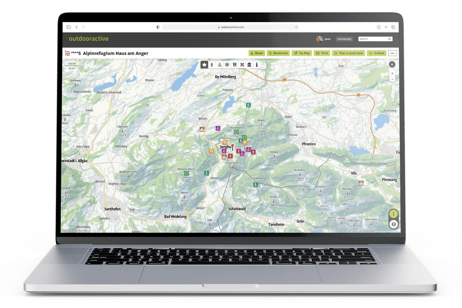
A map that complements a travel guide
Whether planning a day trip or an entire holiday, tourists need to be provided with a wider geographical understanding to make sense of all the information they gather. The questions of how they get to the destination as well as where everything they want to experience is located can only be properly answered in the context of the overall geographical surroundings.
The map is the view from above of the digital world's twin
All digital tourist information is collected in the database and prepared for the map in a clear view. Of course, not all information can be displayed at every scale. We have been developing the Outdooractive map style for over 20 years by displaying the optimal content depending on the zoom level (scale), thus always ensuring an optimal overview
A visual representation of the digital world you create
Our map takes the data that is gathered and added to the database to provide a concise aerial view of your destination. Not everything is visible at every scale, but with over 20 years of develpoment work put into it, the Outdooractive map's style breaks down the information in a manner that is suitable for each zoom level. The result is a map that is both practical and coherent.
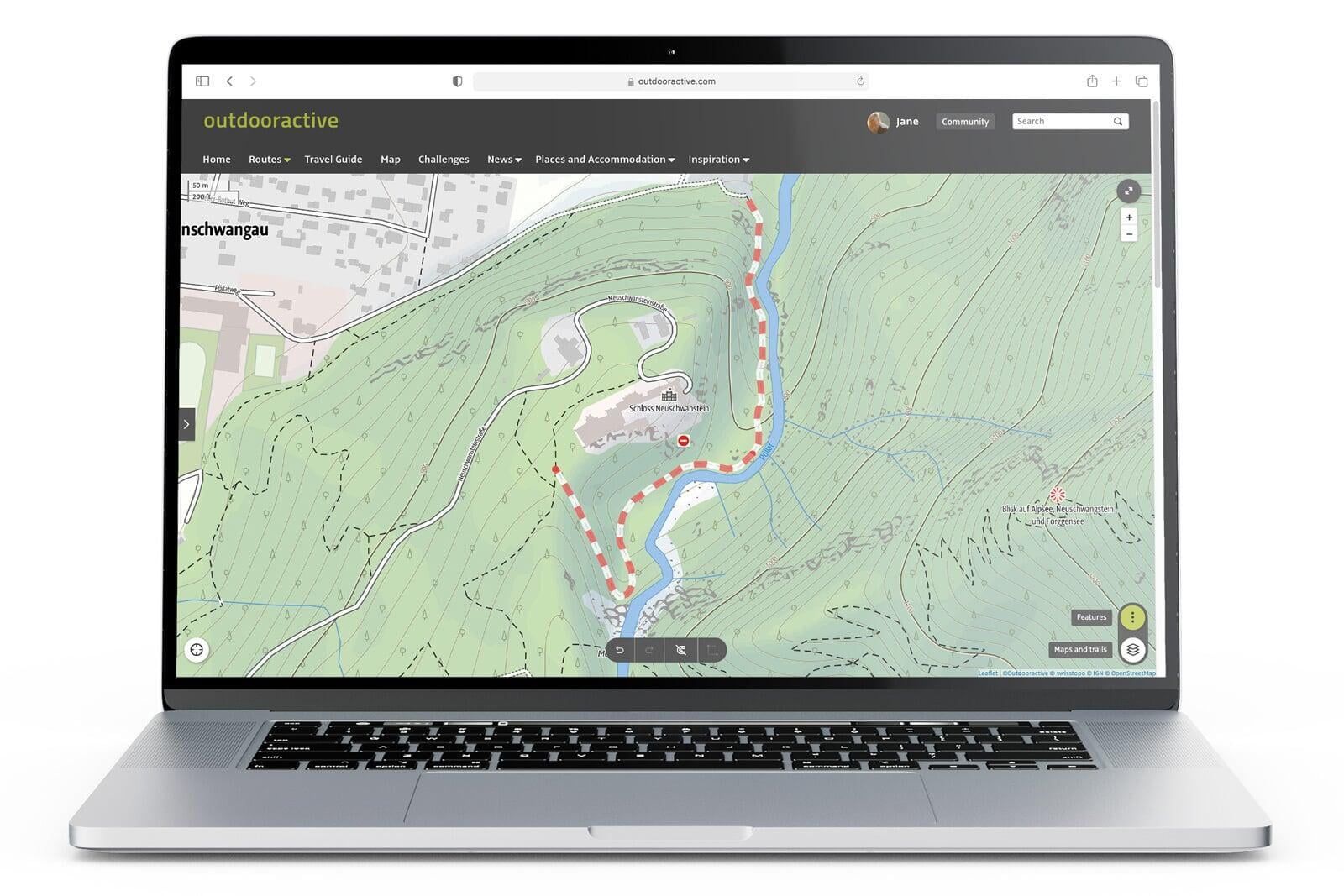
The map used by professionals
Outdoor professionals such as professional guides, trail managers or alpine clubs need to be able to rely on a map to perform their jobs and tasks safely and efficiently. This means that every trail and geological feature must be correctly marked so that they can continue to navigate in even the most adverse conditions to safely get to where they need to be. While highly detailed, traditional topographic maps are often hard to read and present their own limitations. Outdooractive's solution to the problem of overloading the map with information is to break it down into different panels and layers so that specific information, e.g. slope angles, snow cover, etc., can be accessed as and when required.
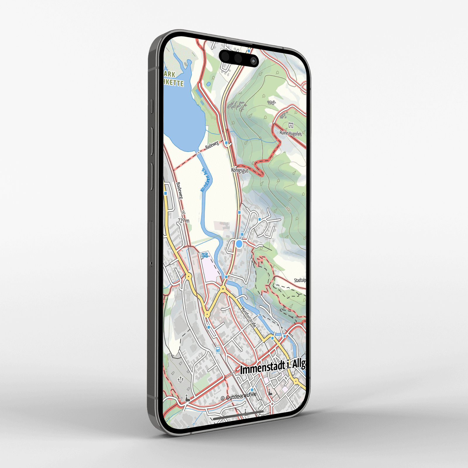
Combining official global maps in one place
Wherever possible, we aim to gather and integrate official maps from national mapping agencies across the world to provide a unique and truly global product. These maps are then supplemented with additional data that is provided by a variety of projects, trail managers and OpenStreetMap (OSM).
An official trail network that is maintained by trail managers
The Outdooractive platform provides the perfect environment for us to work with partners collaboratively and to gather as much official data as possible. An ever-important source of information and local expertise is regional trail managers. They interact directly with the Outdooractive platform as part of their everyday work and help keep tourists informed of current conditions such as trail closures, which are woven into the database and displayed across the platform.
An interactive view of the sourroundings
An interactive view of the sourroundings
Modern vector cartography has ended the days of static raster maps to create a product that is interactive. Elements that are integrated into the display can be tapped or clicked on to reveal additional information. The map can also be rotated on a device to suit the direction to travel while text elements remain static and thus legible, regardless of the screen's orientation.
Trail conditions
Whatever the activity the user likes doing, it is essential that they always know hich type of trail they will be using. Road cyclists will prefer asphalt, wile hikers do not, and mountain bikers will be looking for trails that they know will actually be able to ride on. Outdooractive's map details the way types along a route.
Trails allocated for specific activities
Trails allocated for specific activities
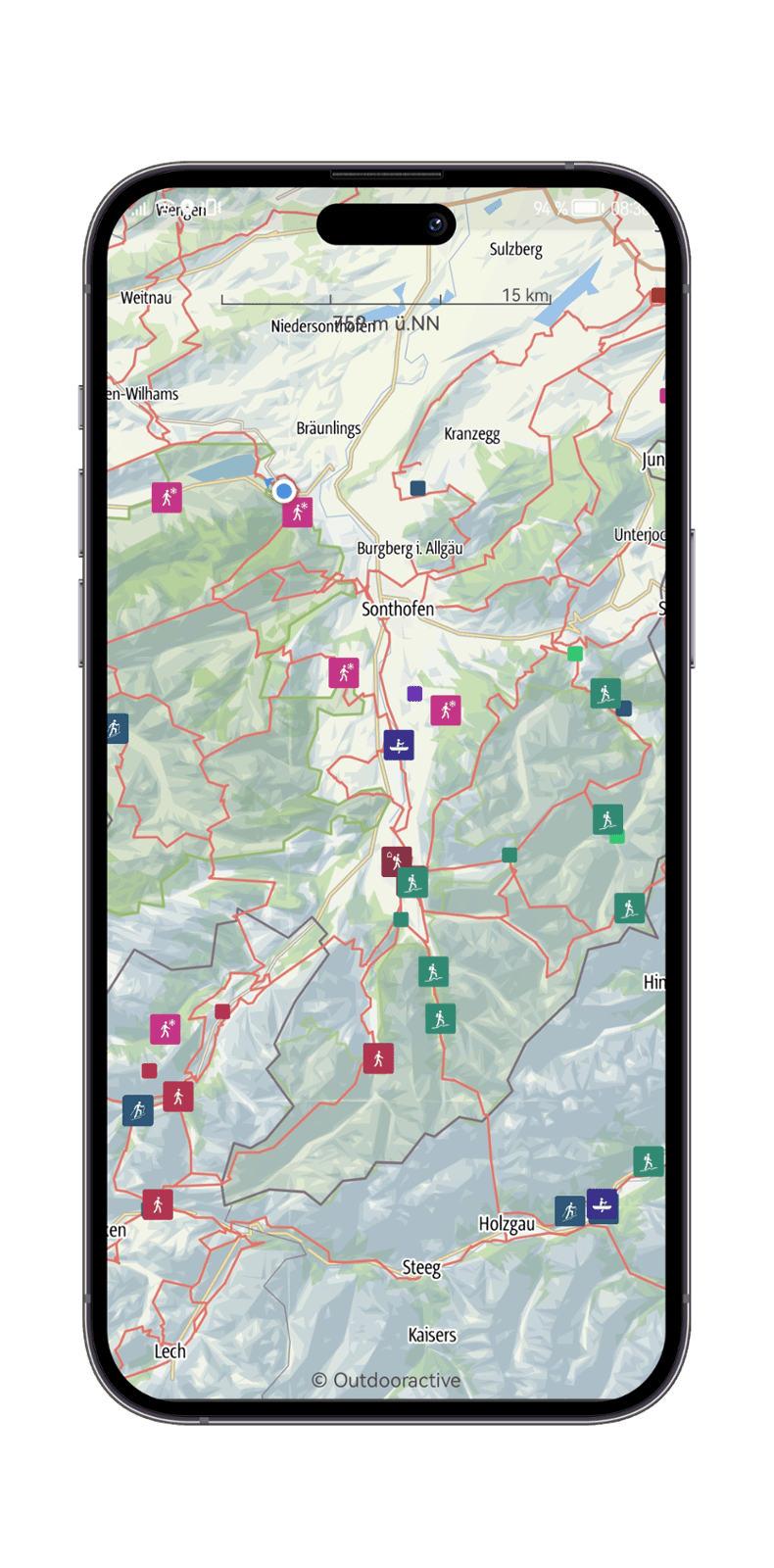
When planning trips around a certain activity, being able to identify and know the official trails for hikers, cyclists, mountain bikers, horseback riders, or for different winter activities is essential. There are three levels of information that we have considered when building our map:
- The officially signposted, marked, and recommended trails.
- Trails on which the activity is permitted.
- Trails on which the activity is forbidden.
Creating routes
By simply entering the name or coordinates of a start point and destination (in much the same way as a user would with Google Maps), or by tapping or clicking directly on the map itself, an optimized route is modeled which can be navigated immediately or saved for later use. Of course, the trail network is factored and based on the user's chosen activity and the difficulty level can be adjusted to suit the user's ability.
Navigating routes
Navigating routes
Most people are familiar with the systems used for navigating when in a car. The Outdooractive app offers the user a very similar experience but in this case, it is along hiking trails, bike paths, etc. The vector data of the map is used to create turn-by-turn directions along the route with the option of additional speech output for those who prefer to keep their device in their pocket.
Winter sports areas
Winter sports areas
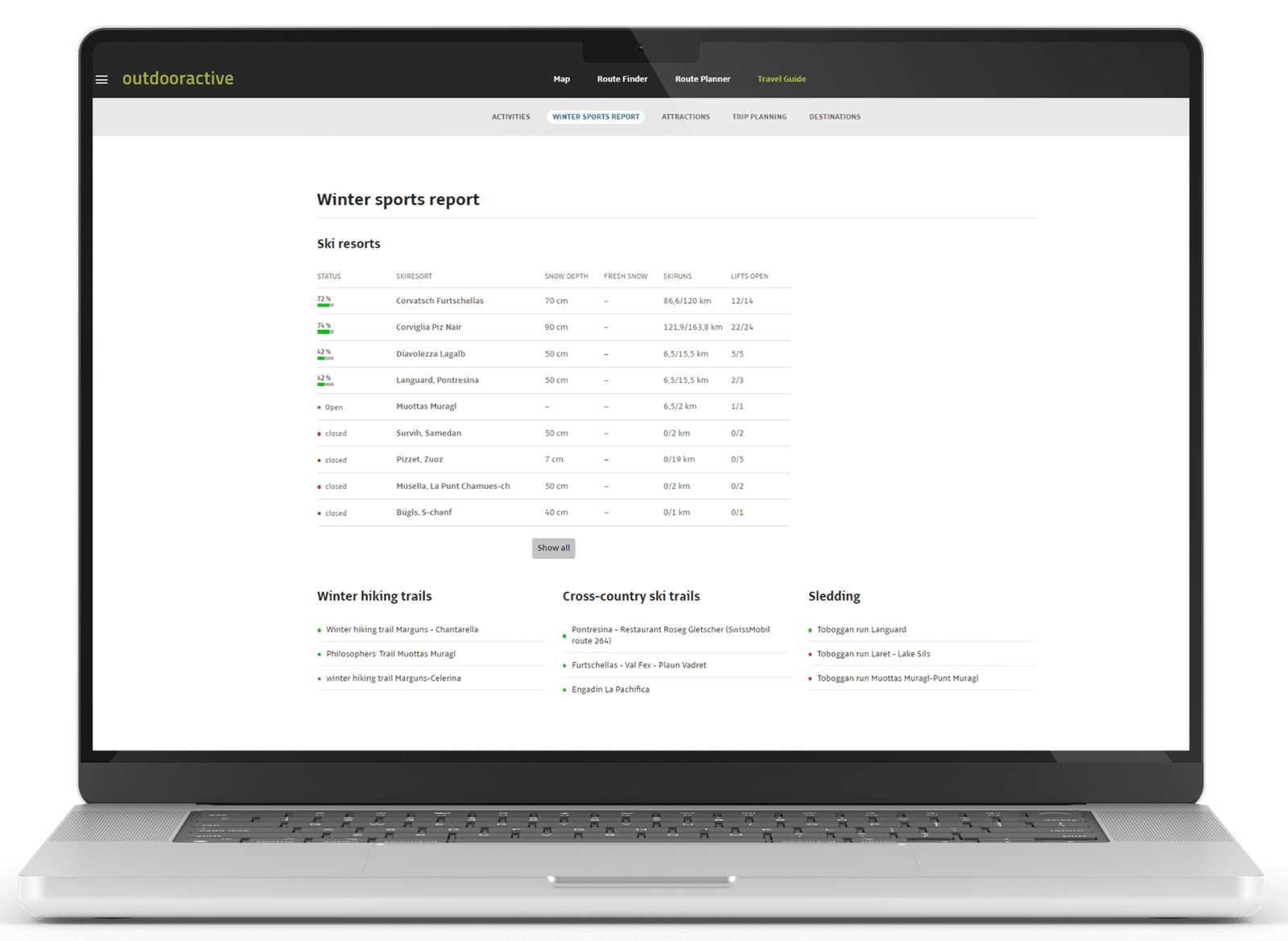
Anyone who enjoys winter sports needs to know about current conditions such as the opening hours of lifts, whether they are operating, what avalanche warnings are in place, and where the toboggan runs, cross-country ski trails and winter hiking trails are. Destinations and ski resorts can either enter this information directly onto the Outdooractive platform or import it from their own systems so that it displays live on the map.
Conservation areas and laws
Conservation areas and laws
The most beautiful places within a destination are usually to be found within protected areas. Guidelines and rules from a huge part of the conservation effort, i.e. what is and is not permitted when visiting, but these are usually hard to access and find - assuming tourists are even looking for them. Outdooractive has taken on the task of digitizing these rules via Digitize the Planet so that the information can be added to our map. The goal is to ensure that anyone visiting a conservation area can be informed and stay compliant with the rules.
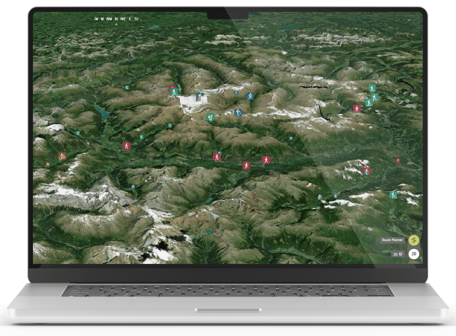
3D map
Outdooractive's map also comprises 3D elements. The highly detailed terrain model, allows a three-dimensional image of the landscape to be created. Especially in the mountains, the ascents and descents as well as exposure and objective dangers can be better assessed when planning routes and trips.
Augmented Reality
Augmented reality embeds the content that is on the map into the camera's view of surrounding landscape. In the case of Outdooractive's Skyline feature, tilting the device to the vertical position and allowing access to the camera will generate information in the screen that shows the names of places, peaks, further terrain features, and directional arrows that follow the route's geometry.
Please don't hesitate to contact us for further information and advice.